UAV for Volcanic Monitoring
The Volcanic Monitoring and Response UAV is a cutting-edge solution aimed at revolutionizing disaster management and scientific research in volcanic regions. With capabilities such as real-time monitoring, magma flow prediction, and automated sample collection, the UAV is engineered to operate in hazardous environments where human intervention is risky. It supports emergency response teams with actionable insights, search-and-rescue functionality, and data collection for scientific analysis. Designed with human-centered principles, the system ensures intuitive operator controls, ergonomic interfaces, and adaptive automation, making it an invaluable tool for volcanic disaster preparedness and response.
Project Process
Research & Analysis
To design an effective UAV system for volcanic monitoring and emergency response, extensive research was conducted on:
Volcanic Behavior & Risks: Studied eruption patterns, gas emissions, and lava flow to determine critical monitoring needs.
UAV Technologies: Analyzed existing UAV models, sensor capabilities, and autonomy levels to identify suitable features.
User Needs & Pain Points: Through research on volcanic monitoring reports, emergency response case studies, and UAV applications, the following user needs and challenges were identified:
Limited real-time data – Existing monitoring tools often provide delayed or insufficient data, making timely decision-making difficult.
Harsh environmental conditions – High temperatures, toxic gases, and strong winds make traditional data collection risky and unreliable.
Cognitive overload & fatigue – Operators must process large amounts of data quickly, requiring intuitive controls and automation to reduce workload.
Navigation & accessibility challenges – Volcanic terrain is unpredictable, requiring UAVs to be highly maneuverable and adaptable to sudden environmental changes.
Component Development
Based on research findings, the UAV system was designed with key functionalities:
Real-time Monitoring: Equipped with thermal imaging, gas sensors, and high-resolution cameras for live data collection.
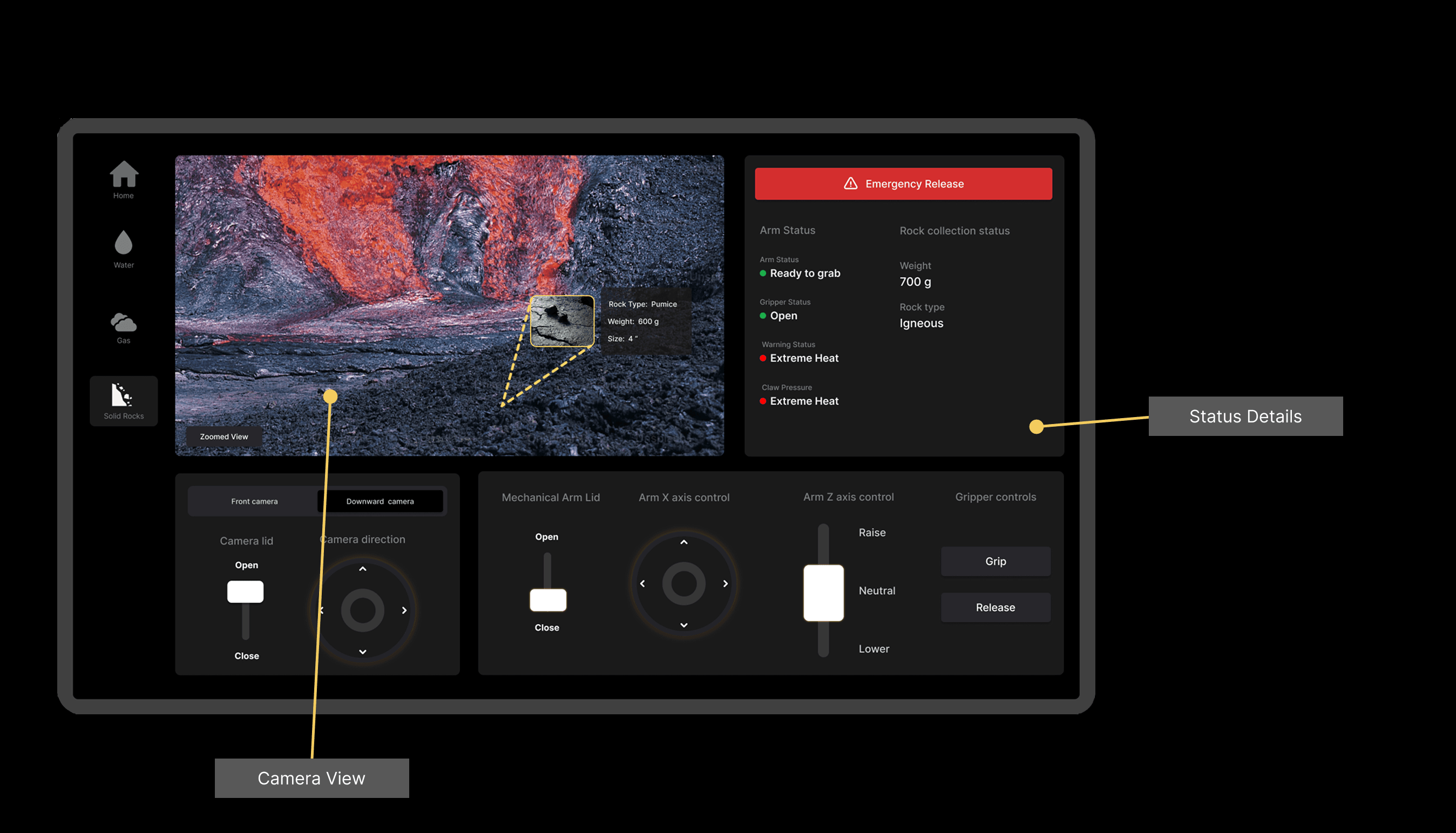
Data & Sample Collection: Integrated robotic arms and droppable sensors for field measurements.
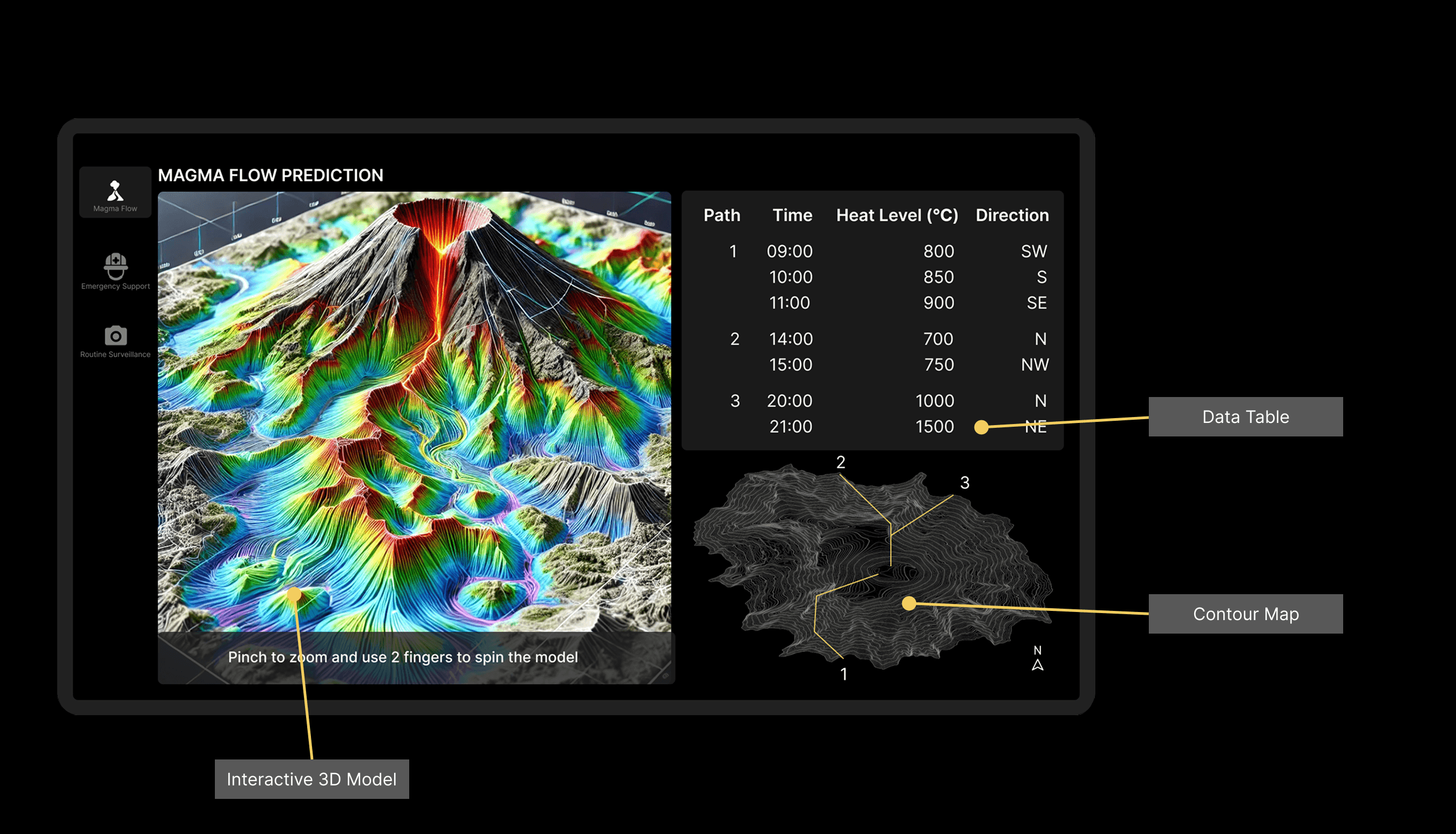
Magma Flow Prediction: AI-based analysis of satellite and UAV data to model lava progression.
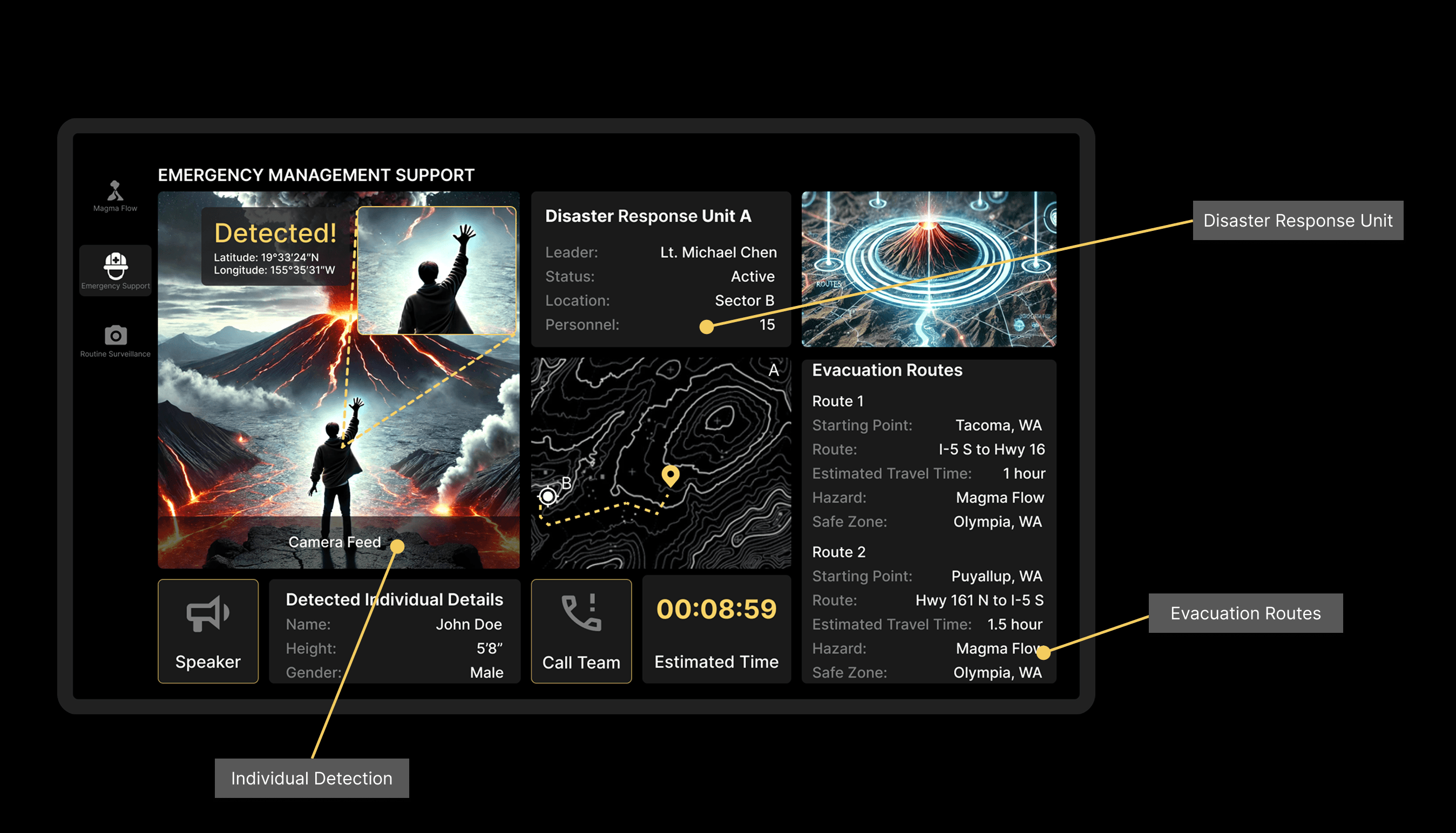
Search & Rescue (SAR) Assistance: UAV-supported reconnaissance to locate missing individuals in hazardous areas.
Defined operator roles to optimize workflow:
Pilot – Navigates UAV, ensuring stable flight in turbulent conditions.
Payload Operator – Manages cameras, sensors, and data capture tools.
Emergency Coordinator – Analyzes UAV data for risk assessment, evacuation planning, and SAR operations.
Design Phase
Human-centered design principles ensured usability and efficiency:
Cognitive Load Reduction: Simplified controls, automated alerts, and AI-assisted decision-making.
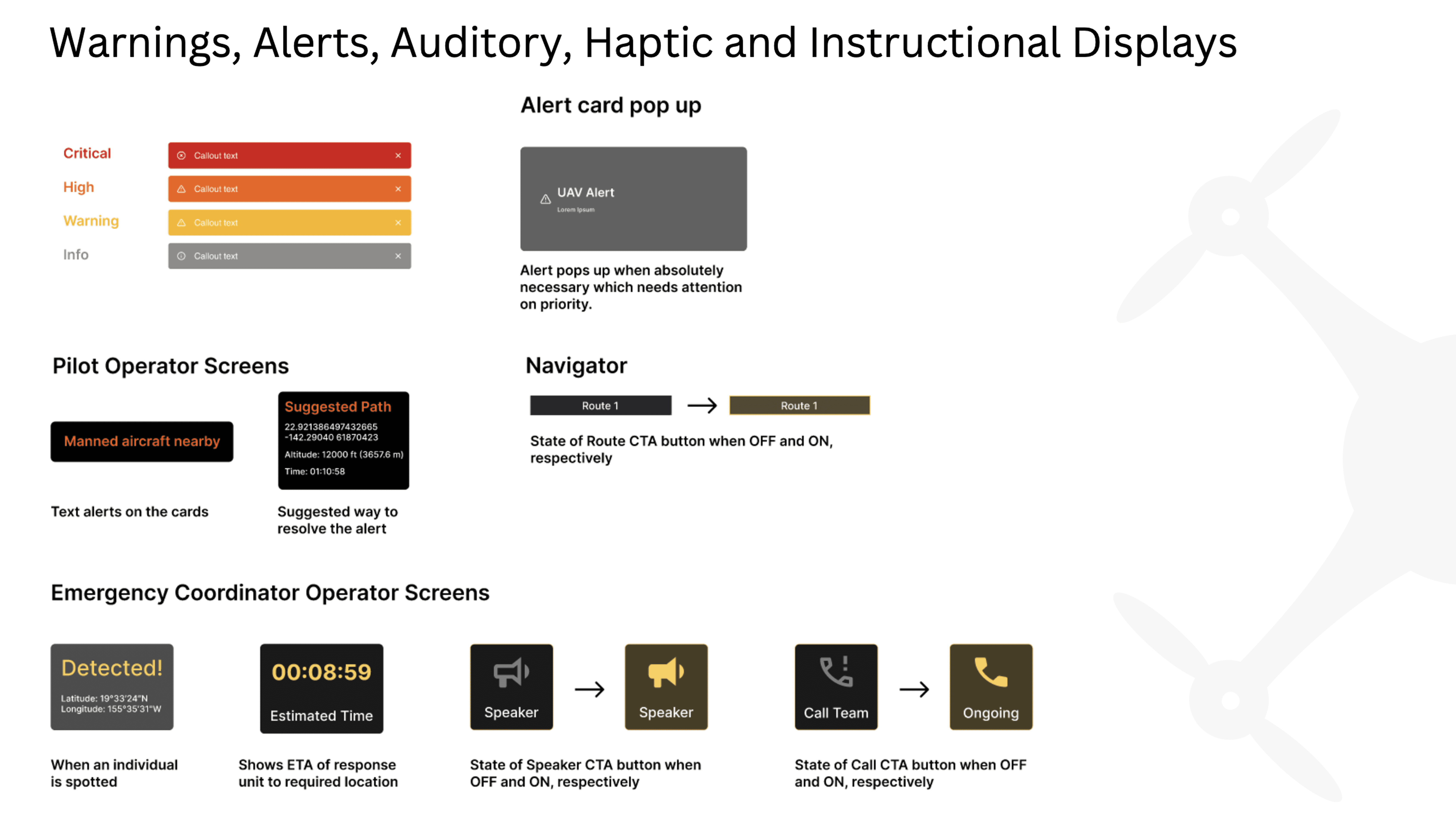
Attention & Perception: Designed visual displays with color-coded alerts for immediate hazard recognition.
Ergonomic Considerations: Used anthropometric data to optimize workstation layouts for prolonged operator use.
Mental Model Alignment: Interfaces designed to match operators' expectations based on existing workflows and prior training.
Prototyping and Testing
Scenario-Based Simulations: Evaluated performance in simulated volcanic events to assess real-time decision-making.
Work-Rest Optimization: Developed a fatigue management schedule based on cognitive workload studies to maintain operator alertness during extended missions.
Key Features
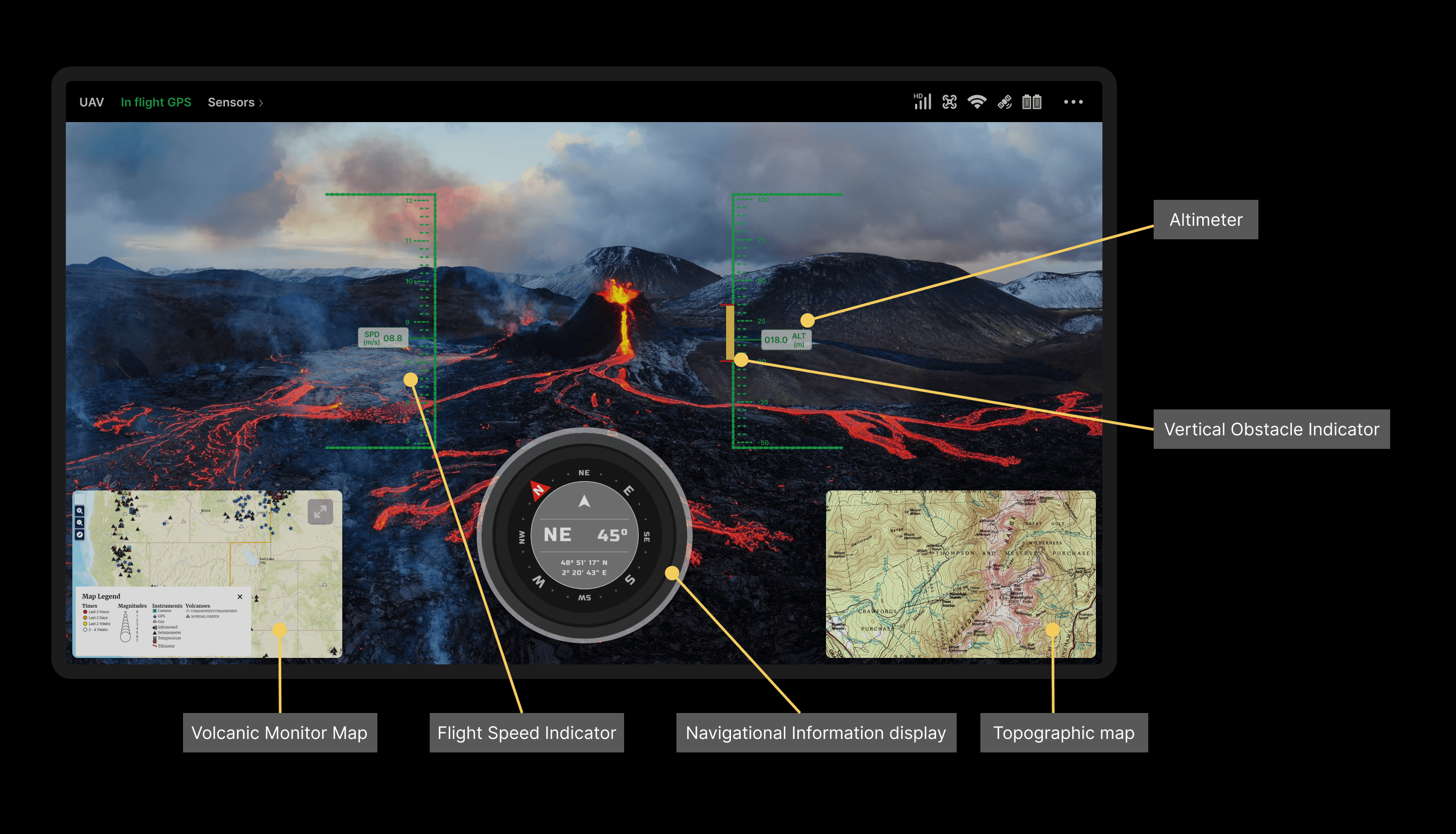
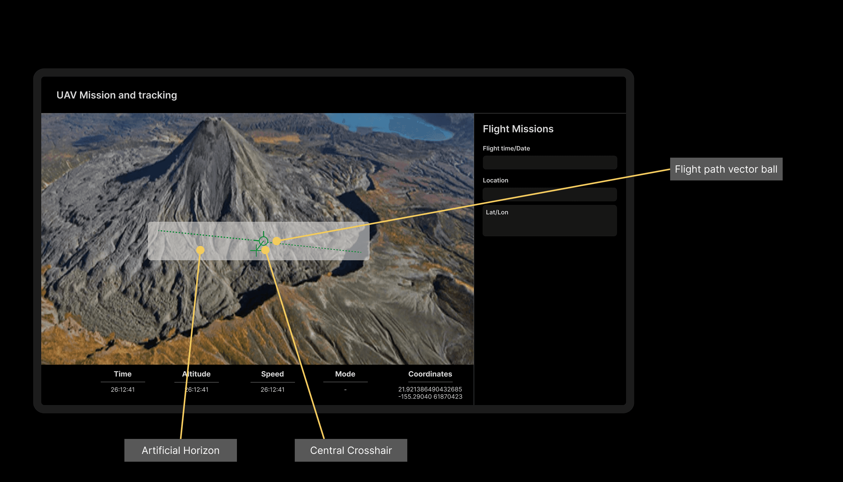
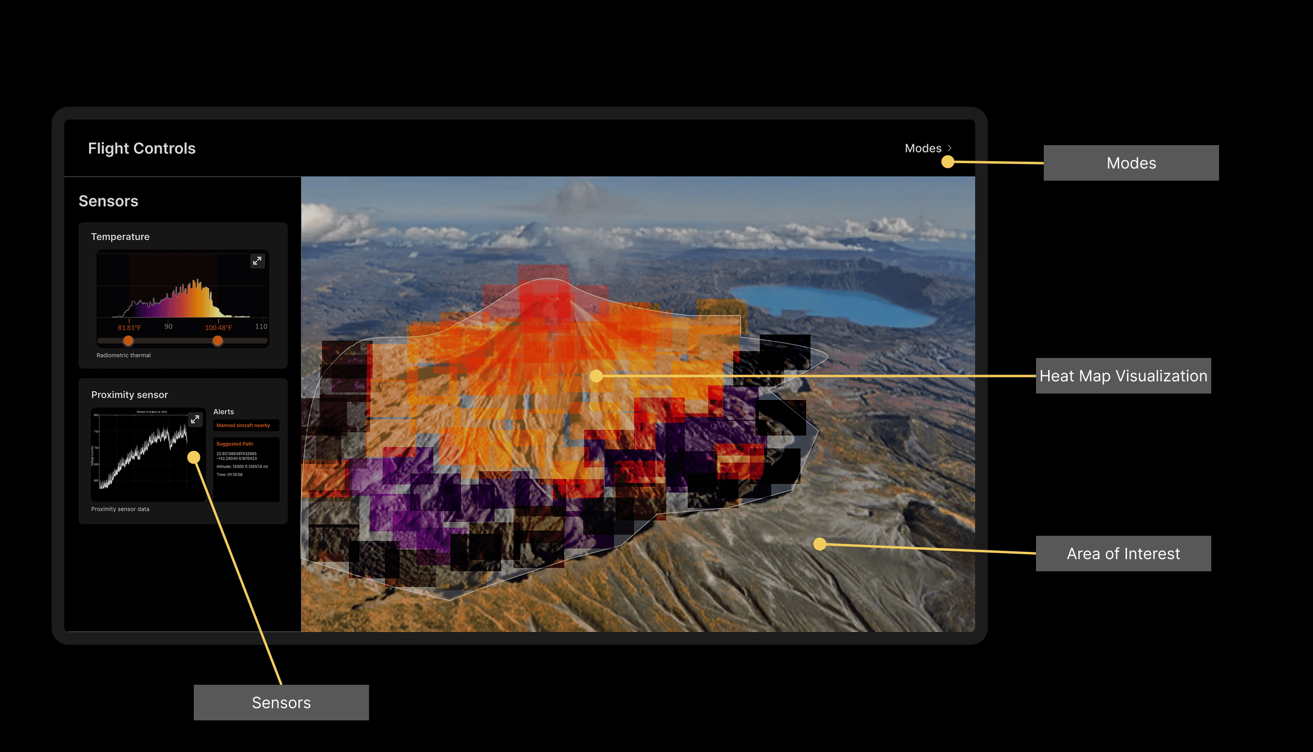
Real-Time Monitoring
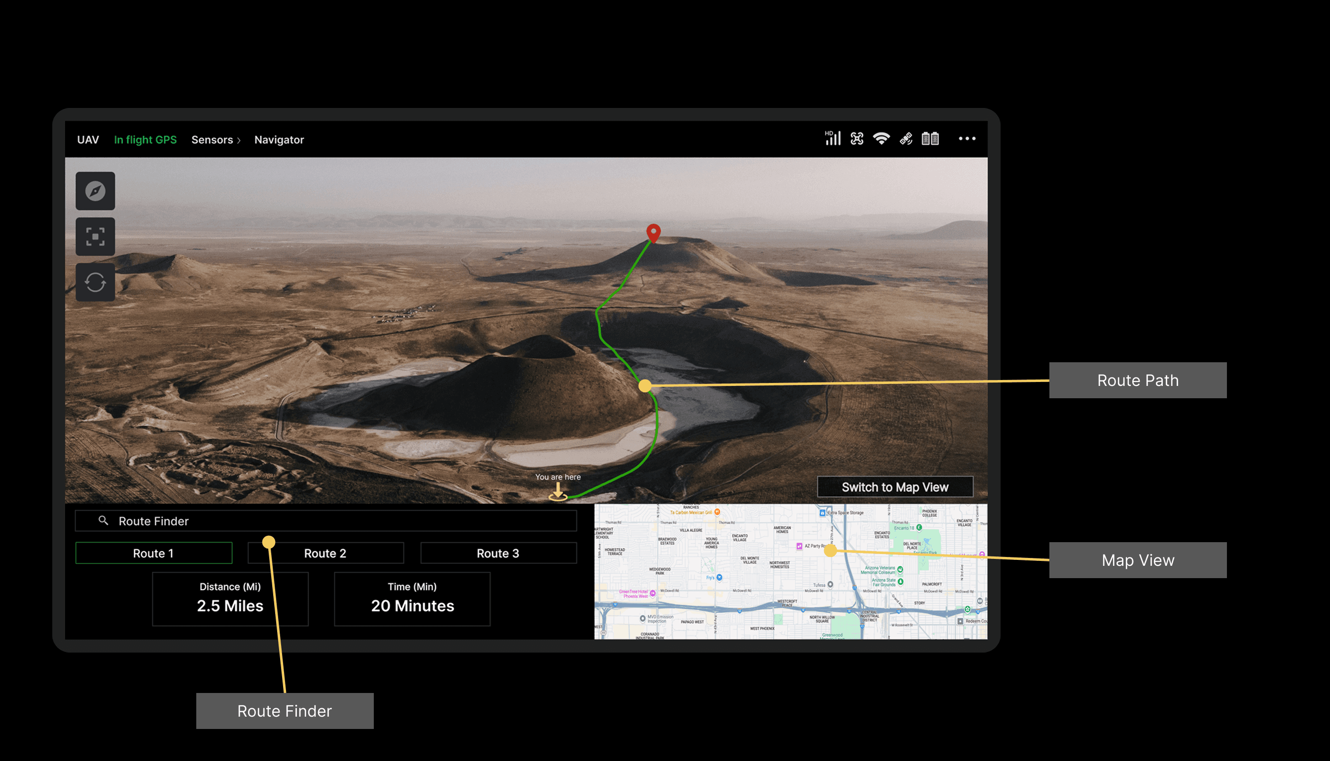
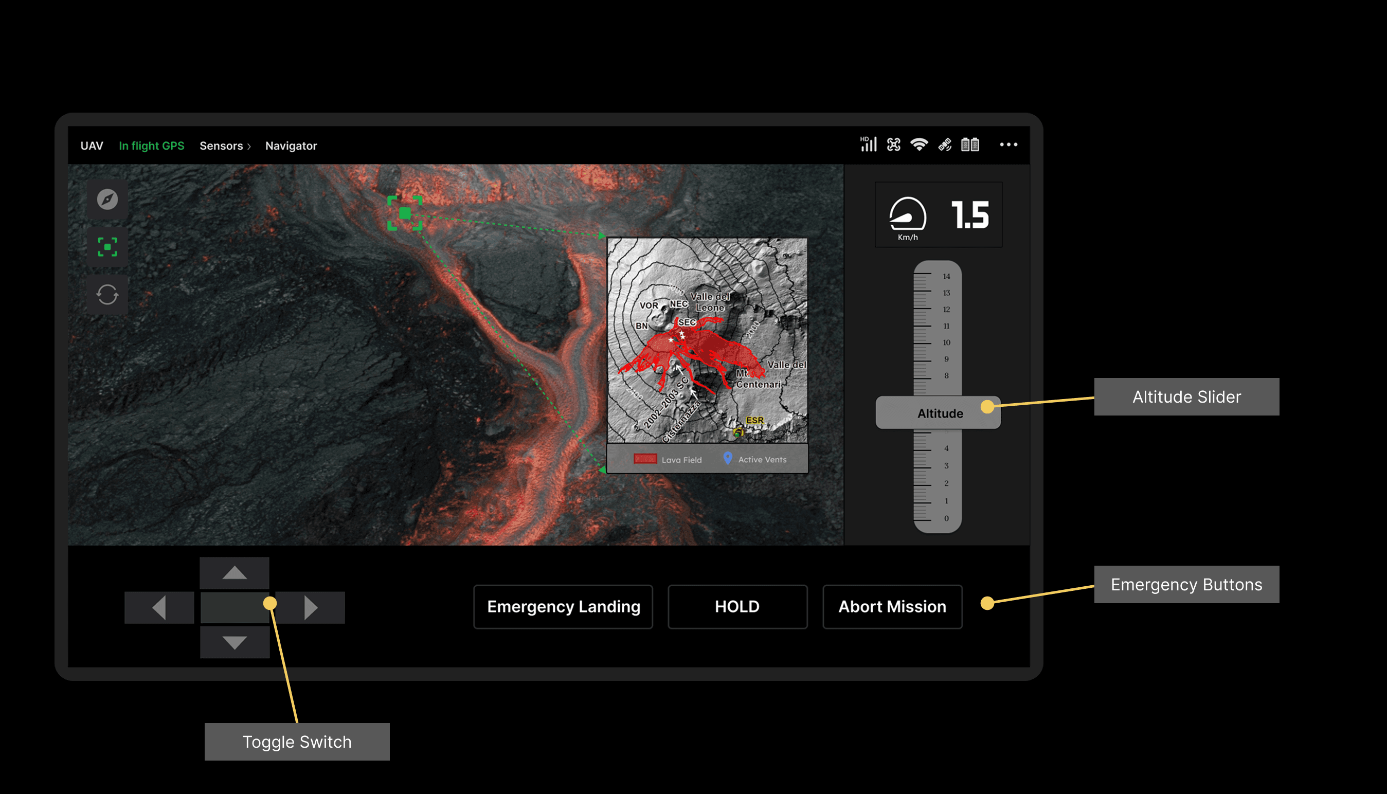
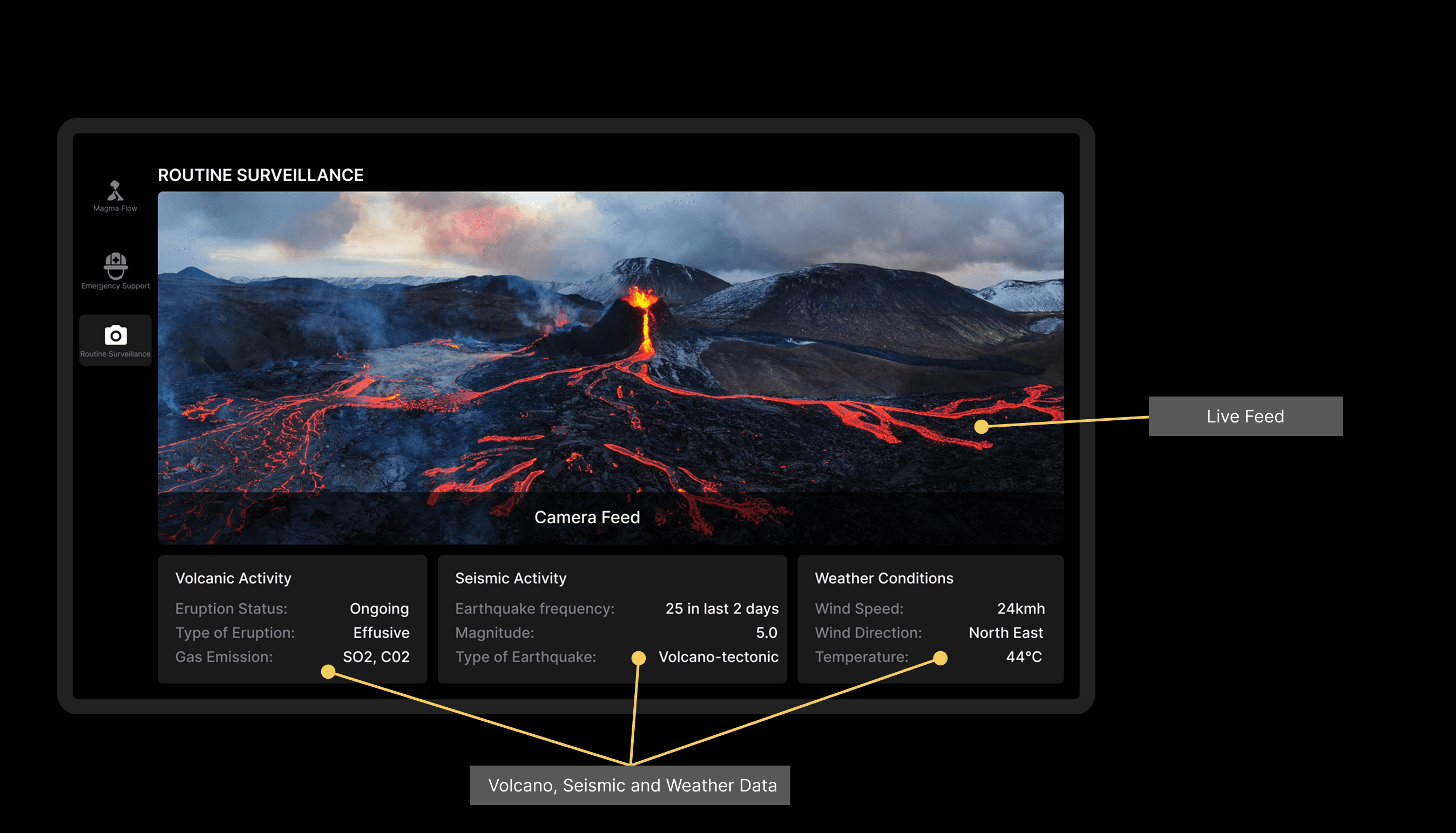
Topographic maps with live data overlays for active vents and magma flows.
Heat map visualizations and camera feeds for detailed area analysis.
Magma Flow Prediction
AI-powered analytics provide forecasts of magma paths, aiding evacuation planning.
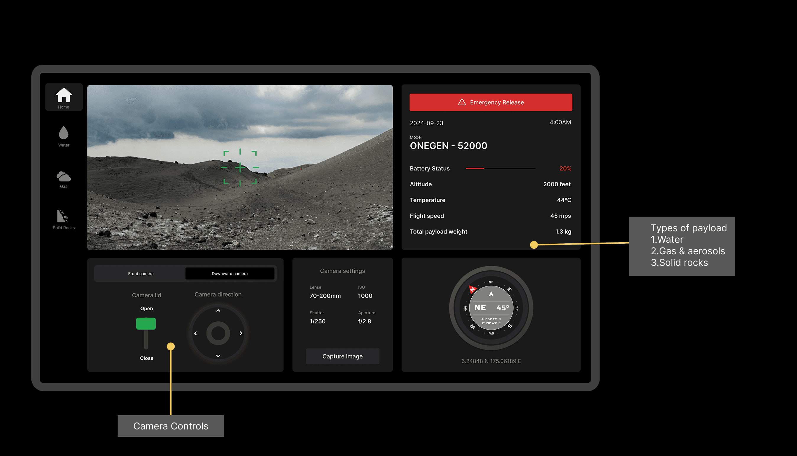
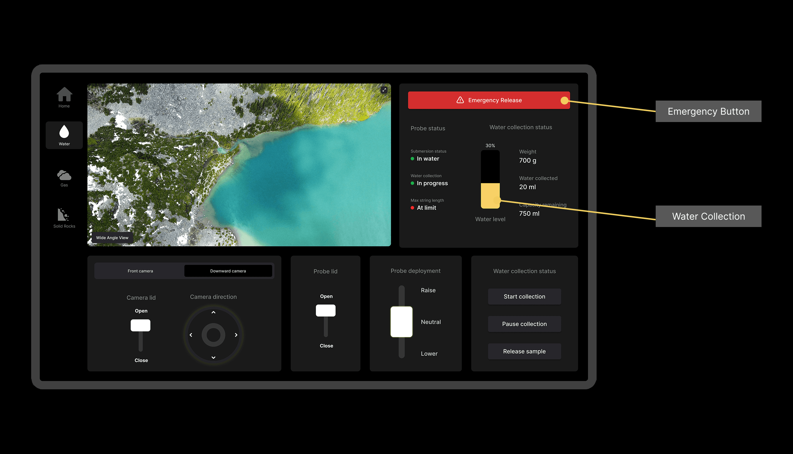
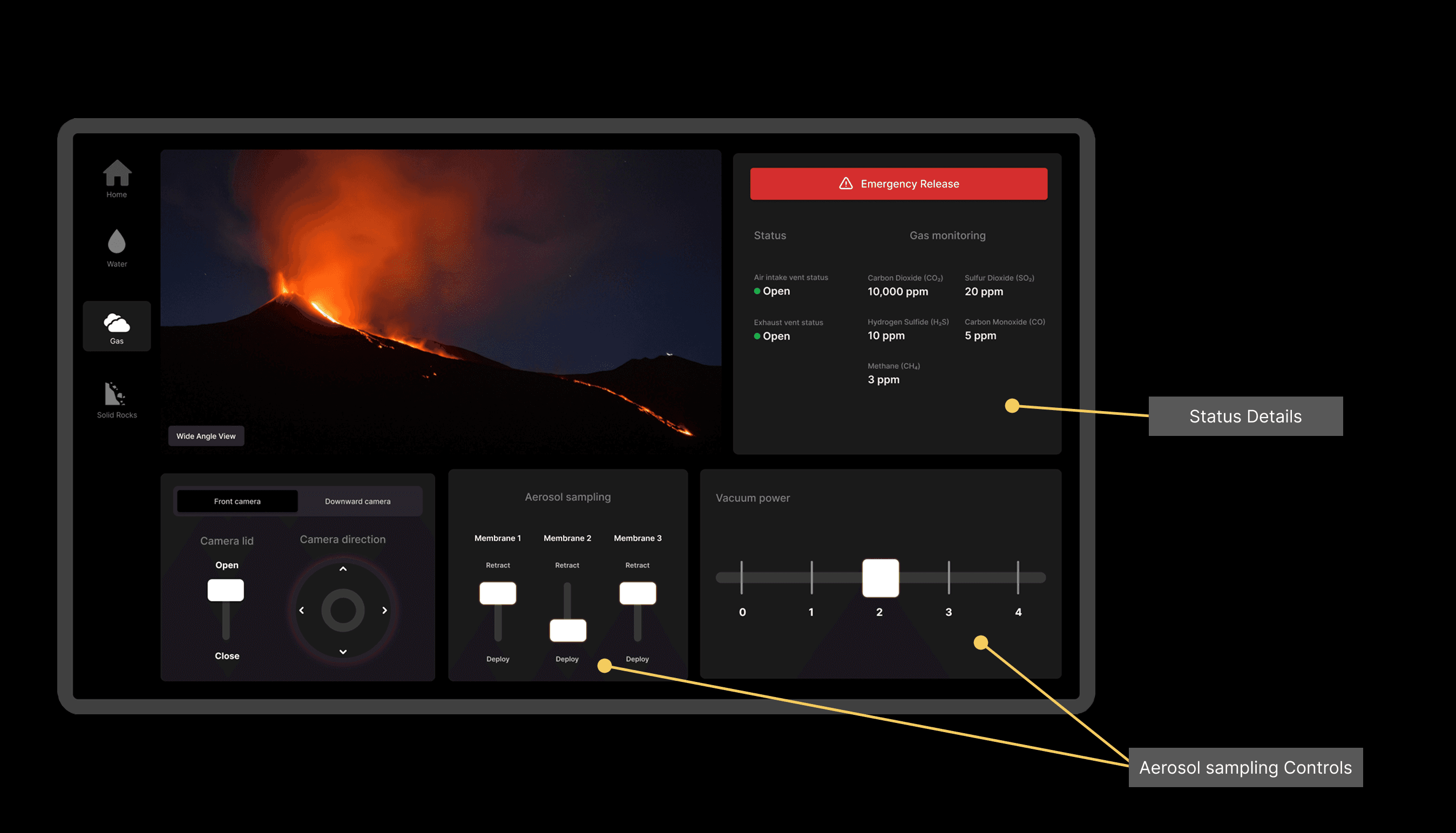
Automated Sample Collection
Automated mechanisms for gas, water, and rock sampling.
Predictive analytics for sample weight and gas emission patterns.
Operator Interfaces
Role-specific screens designed for ease of use, emphasizing proximity compatibility, visual salience, and accessibility.
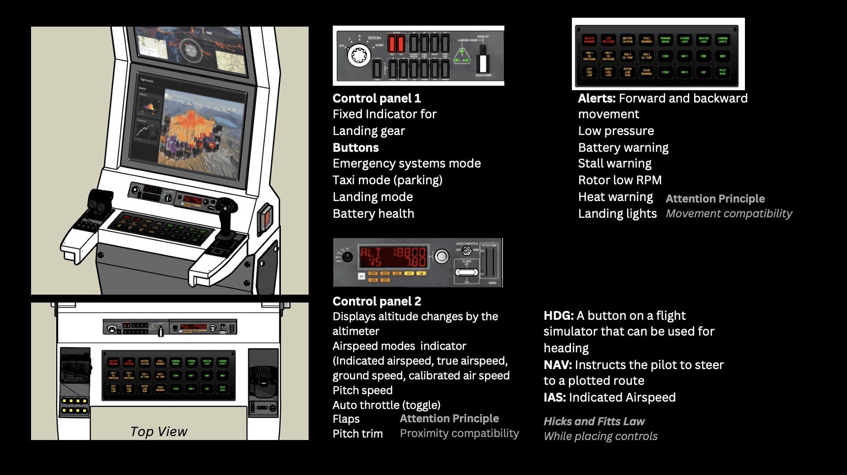
Emergency controls and auditory/visual alerts for quick response to critical events.
Human Detection & SAR Support
Computer vision identifies individuals in danger, with features for two-way communication and evacuation route guidance.
Screens:
Pilot Operator
Navigator
Payload Operator
Emergency Coordinator Operator
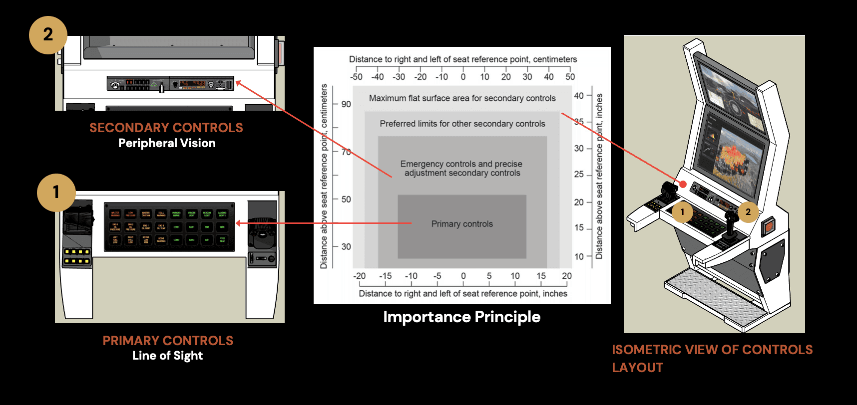
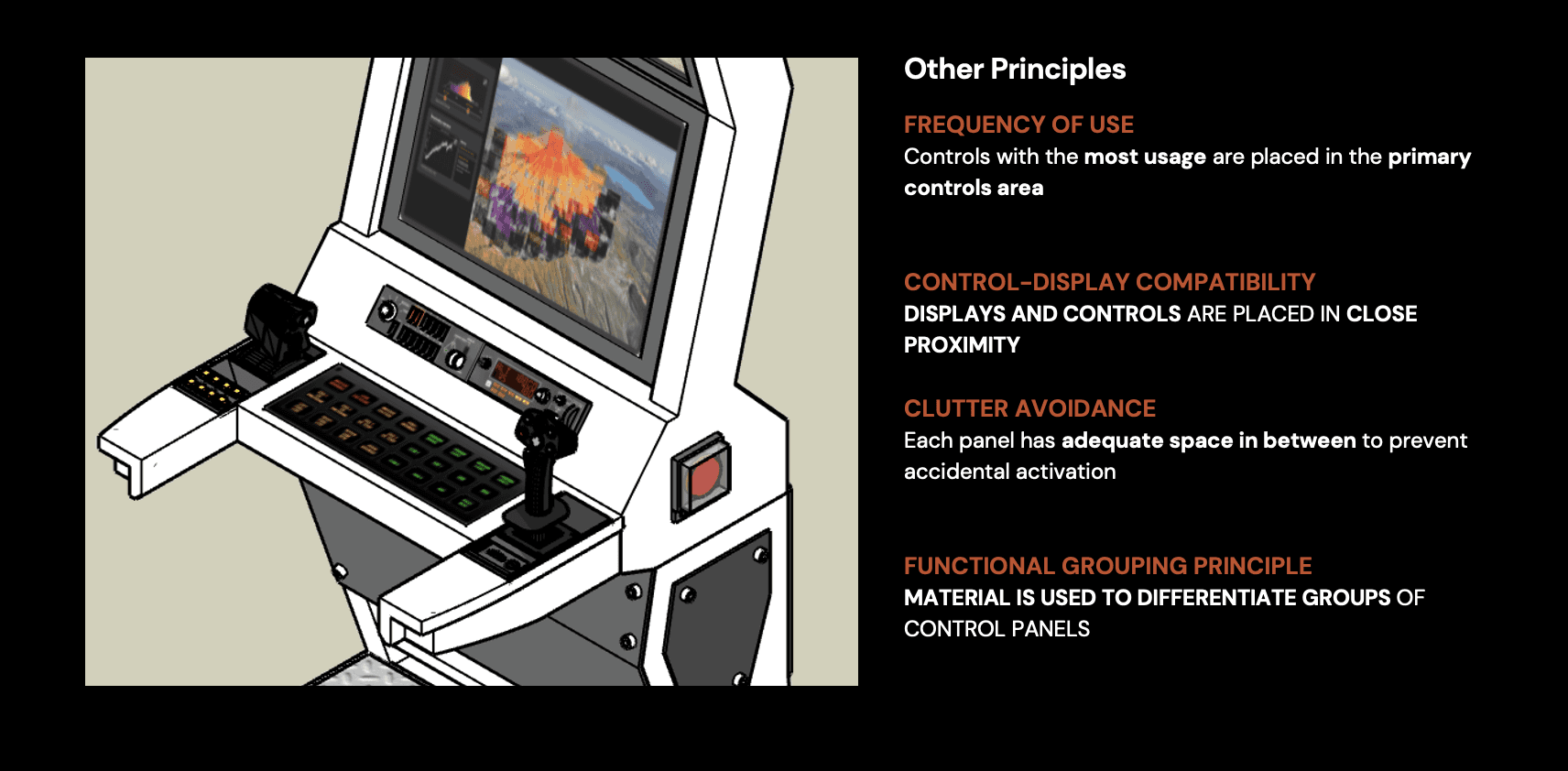
Controls and Workspace Design
Pilot Operator Controls
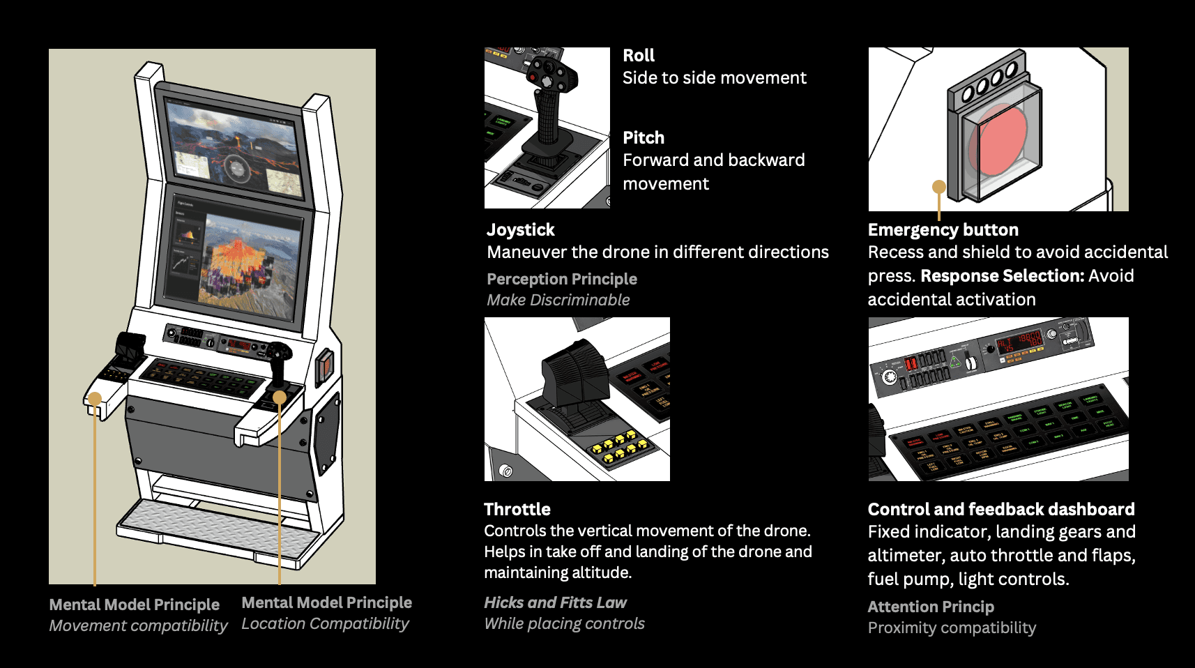
Center Control Panel and Alerts
Emergency Coordinator Operator & Payload Operator Controls
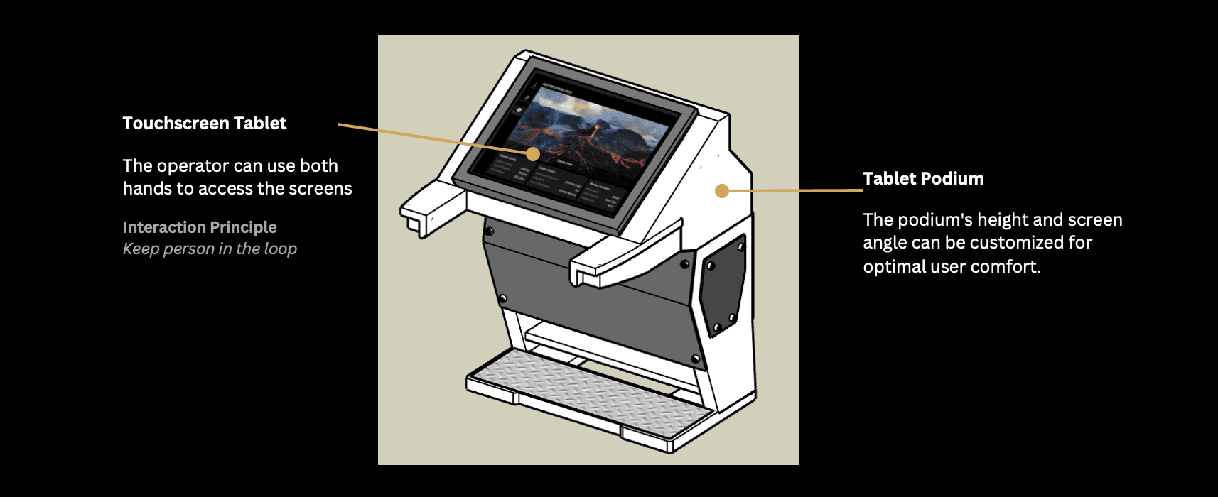
(Mounting the touchscreen tablet on a podium can ensure that both hands are free for other tasks, such as operating additional equipment or communicating with ground teams.)
Component Arrangement
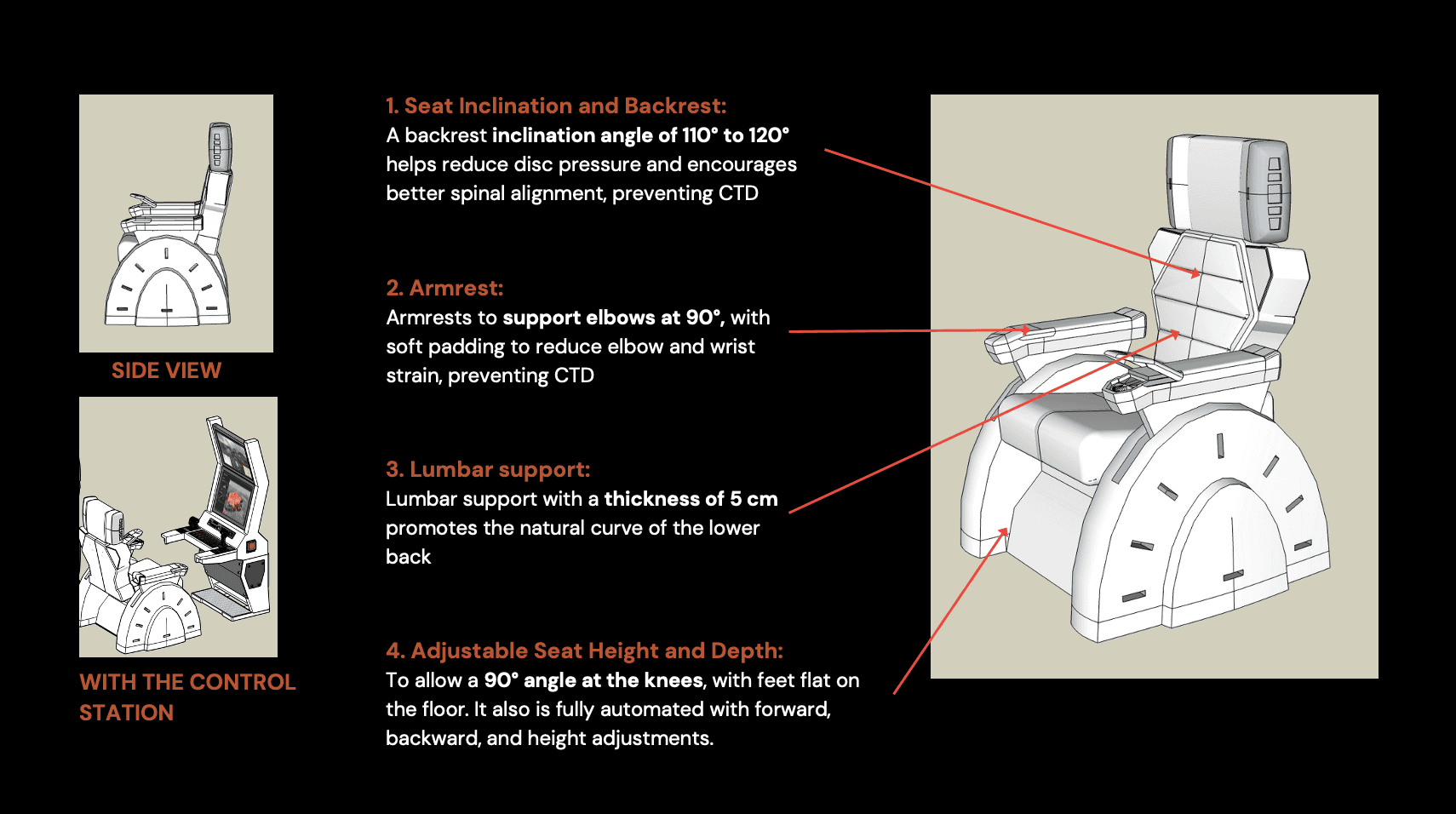
Designing a Biomechanical Chair for Workspace
Key Takeaways
Iterative Design Approach
The project emphasized the importance of iterative prototyping, testing, and refining to develop a highly functional and user-friendly UAV system.
Human-Centered Design
Prioritizing user needs led to intuitive interfaces and ergonomic controls, minimizing cognitive load and improving operator efficiency.
Integration of Principles
Attention, perception, memory, and mental model principles were thoughtfully incorporated to enhance usability and decision-making.
Collaborative Innovation
The interdisciplinary collaboration between engineers, designers, and AI experts was crucial in creating a well-rounded solution.
Design for Scalability
The modular and adaptable design ensures the UAV system can be customized for diverse disaster scenarios beyond volcanic monitoring.